 |
| A quick stop on Mt William, below the summit |

 |
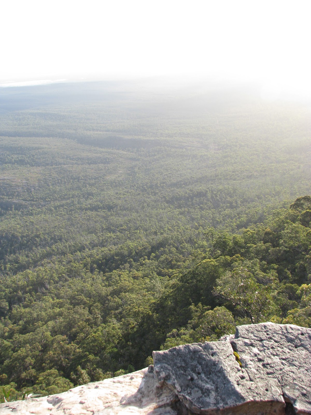
| View from Mt. William summit, highest point in the Grampians |


 |
| Angela, quietly contemplating the beauty of Silverbend Falls |


 |
| Michaela and Aldo. They have way better cameras than mine |
 |
| View from Boroka Lookout. That's the town of Halls Gap below, in front of Lake Bellfield |
 |
| I couldn't find any information about who this person was or why there is a plaque dedicated to him at Boroka Lookout. If anyone can provide any, I'd love to have something more interesting to say here. |
 |
| Mackenzie Falls |


 |
| View from The Balconies |


 |
| Laugh all you want. It was cold and windy up there. Also, there's 3 people under that blanket. Attaboy, Aldo |

 |
| Frank was not afraid of a little wind or a long drop to the canyon floor |
 |
| Sunset at The Balconies |

 |
| Doot doot doo, lookin' out my cabin's front door |
 |
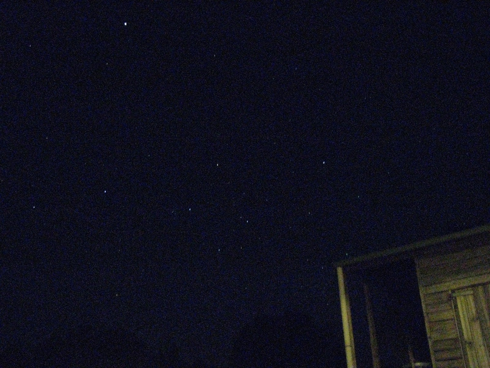
| Aldo taught me how to take pictures of the stars at night. I didn't realize my camera could do that! |
 |
| Orion's belt. I still don't see the pot. |
 |
| Michaela and Aldo, hiking up to Beehive Falls |
 |
| Gulgurn Manja Shelter (I think) |

 |
| These hand paintings are thousands of years old |


 |
| There was a beehive in one of the crevices. I took a bunch of high-speed shots. The bees were faster than my camera. |


 |
| Hollow Mountain, seen from Gulgurn Manja Shelter |

 |
| Michaela and Angela, looking for Aldo. He's in the picture. I promise. |
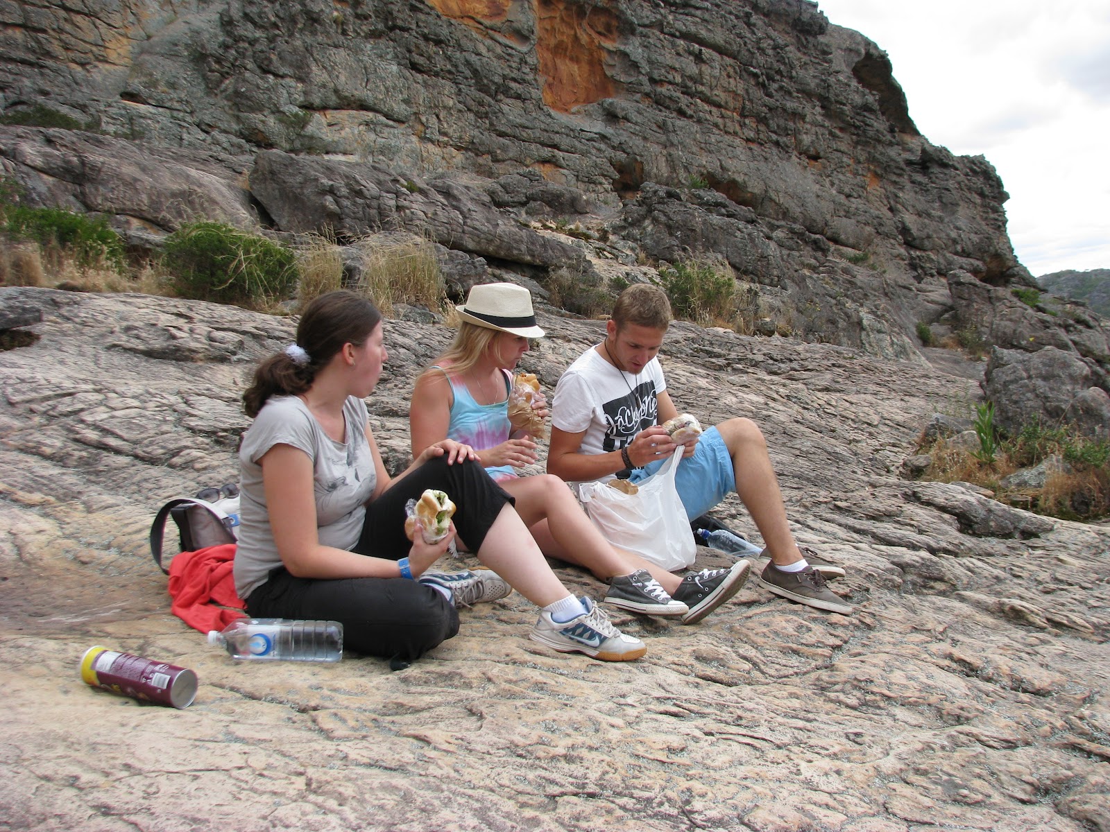 |
| We stopped for lunch on top of Hollow Mountain |


Videos:
| A wallaby we didn't hit with the car |
This past weekend, the roommates and I trekked up to Grampians National Park for one last Australian excursion together before Aldo went home to Switzerland. We left Saturday morning after Angela got home from work, loaded up into Aldo's car, and hit the road.
Two and a half hours later, we stopped at the Shell station in Ararat to fill up the car and get some snacks and whatnot, then continued for another 45-ish minutes up to Halls Gap (stopping again for some beer and wine on our way into town), then cruised down Grampians Road through town and checked in to our cabin. We got there a bit early, and the place wasn't quite ready, so we ducked back into town to the grocery store and got some supplies for lunch and did a bit of window shopping before heading back to the cabin to eat our sandwiches. We had to make our sandwiches on rolls because, by law, Europeans aren't allowed to use sliced bread for anything except toast. They are, however, allowed to put Pringles on their sandwiches, for a bit of extra crunch.
After lunch, we climbed the summit of Mt William, the highest point in Grampian National Park. The carpark is situated 920 meters (about 3000 feet) above sea level. From there, it's a 1.8km (just over a mile) hike up a steep, yet nicely-paved track, to the summit, which sits 1,167 meters (about 3800 feet). By my calculations, that's a 15% grade. For over a mile. On foot. Both ways.
We stayed at the top of Mt William for quite a while to catch our breath, seeing as how the view took away what the climb didn't. It was beautiful up there, even with the radio towers and such. A small memorial marking Maj. Mitchell's 1836 ascent showed the distances from the summit to various landmarks which are visible from the summit.
Leaving Mt William, we hiked to Silverbend Falls. It wasn't really much of a waterfall, but the cliff face was nice to look at, and we took a few pictures there before driving back up the mountains to Boroka Lookout. What a view! The lookout faces Southeast, offering a spectacular view of the town of Halls Gap and Lake Bellfield behind it, nestled between the mountains. Aldo snapped a picture and showed it to the girls. "Wow, where is that?" Michaela asked.
After Boroka Lookout, we drove a little way further, to Mackenzie Falls. With the warmer weather and clear skies, it was even better this time around, albeit considerably more crowded. While my friends were setting up their cameras, I snuck around the plunge pool for a little "waterfall baptism". It felt wonderful.
We could have stayed at Mackenzie Falls much longer, but we wanted to get on up to the Balconies in time to watch the sunset. It was a much higher altitude than Mackenzie or Boroka, and as the sun sank ever lower in the sky, a cool breeze began to blow, growing cooler by the minute. It was an easy hike from the carpark, around 500 meters along a relatively flat gravel trail, and the girls though fit to bring a blanket from Aldo's car. It came in handy for them, since the wind coming up out of the valley and over the mountain was pretty brisk.
As we waited for the sunset, we espied a young couple further down, across the barrier fence on the rocks, drinking beer and being generally romantic. Seeing us, they packed up their stuff and left, I can only assume to find a more secluded spot. It was an easy climb down - the rock was cut into steps and a narrow pathway years ago before they moved the fence up further away from the cliff face. The spot was perfect, and we stayed there taking pictures of each other on the rocky outcropping while we waited for sunset.
While we were waiting, a young German backpacker hopped the fence and offered to take our picture, rather than having one of us set a timer and then run across the unfenced outcropping (it's a long way down). He introduced himself as Frank, and in exchange for his help, we took pictures of him on the rocks. He brought a teddy bear his girlfriend had made and given him before he left Germany, and had made it a point to take pictures of himself with it in all of the places he visited.
We sat with Frank on the Balconies, taking pictures of the sunset, and swapping stories about our travels, climbing back up to safety before it got too dark. He was living out of his station wagon (a Ford Falcon, similar to what I'd taken on my first road trip), though I don't know how he managed to find a place to sleep with his surfboard taking up so much space. We gave him one of our maps and told him of a couple places of interest we had learned from the information center, then parted ways.
Returning to our cabin, we found that the proprietor had not been exaggerating about kangaroos grazing in the courtyard at night. They appeared to be quite accustomed to human presence, grazing at a safe distance but allowing us to come close enough to take some decent night pictures (though they didn't always stand still enough for the long shutter times we needed). They didn't even seem to mind the flames from our disposable barbecues.
Now, a disposable barbecue is a pretty interesting device, something I'd only been introduced to in Australia. It's a simple aluminum foil baking pan filled with charcoal briquets, with flammable starter paper atop it and covered with a thin aluminum grate. You light the paper and it catches the charcoal. About 15 minutes later the flames go out and you're left with a pan full of red hot coals, perfect for grilling burgers, hot dogs, whatever you like. Since the wind was blowing a little, and this was the first time I'd used one of these contraptions, I covered them with a large stainless steel lid from the kitchen. It worked really well, and both the burgers and sausages turned out deliciously.
After dinner, we went back outside and Aldo showed us how to take pictures of the stars. I don't have nearly the camera that he or Michaela has, but I was pleasantly surprised with how mine turned out. Later, Aldo set up his tripod and did some cool camera tricks with a flashlight - he has a remote control which allows you to hold the shutter open indefinitely. Push the button, and the shutter opens. Then you can wave the flashlight around in front of it and paint a picture with light. Push the button again and the shutter closes, and you get to see the result of your efforts.
We slept in the next morning, having stayed up pretty late taking pictures outside. After eating breakfast, packing up, cleaning up, and checking out, we headed back into town for some supplies and then drove up to Beehive Falls. I misread the map and we missed our turn in Halls Gap, but the GPS turned us back around and got us on the right track, a long gravel road which runs North out of the town, all the way up to Mount Zero.
The hike to Beehive Falls was pretty long, maybe a mile or so, though the trail was well maintained and layered with gravel. We were a bit stumped when it ended abruptly at the base of a mountain, but there was no waterfall to speak of. There was a pretty good view nonetheless, and we all agreed that it would make for some spectacular views of the stars if we had been able to climb up to the top at night.
Leaving Beehive Falls, we saw a wallaby on the track back to the car park. We followed it for a little while and took some pictures, and a video or two. Then we went further North, not quite to Mount Zero, but up to an Aboriginal site named Gulgurn Manja Shelter, where we were able to see ancient rock art, painted on the mountain walls in red ochre. We took pictures, not only of the paintings, but of the mountains and the lowlands. Aldo climbed up to the top and got some great views, before we continued our hike to Hollow Mountain.
If the track up to Hollow Mountain was steep, the trail up the mountain was all but vertical. It took us nearly an hour to reach the top, but when we got there, we found it was well worth the effort. We could see for miles in all directions, and the mountain of Gulgurn Manja seemed so small by comparison. We stayed there for an hour or two. I took a nap on the rocks while the rest of my party wandered around looking for a better vantage point. We met again and had lunch on top of the mountain, then sat on the rocks and took in the view, until we decided to head back home around 4:00.
No comments:
Post a Comment